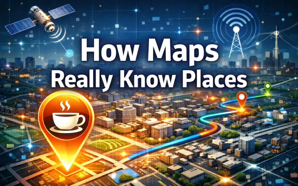
1 Introduction: The Illusion of Simplicity
Most people open a maps app, type “coffee,” and expect useful results almost instantly. They don’t think about what happens next, and honestly, they shouldn’t have to. The interface is clean, responsive, and calm. But that simplicity hides one of the largest and most complex data systems running in production today.
Anyone who has worked on large distributed systems knows that sub-second responses at global scale don’t come for free. Still, even experienced engineers tend to underestimate what modern digital maps are doing. A simple POI search is not a lookup in a tidy database. It is the final step in a long chain of continuously running pipelines that process years of historical data, petabytes of sensor input, and live signals arriving every second from around the world.
This article explains that hidden machinery. It walks through how platforms like Google Maps and Apple Maps maintain a living, constantly updating model of the physical world—one that often “knows” about a new coffee shop before anyone explicitly submits it. More importantly, it shows the engineering decisions that turn raw imagery, noisy GPS traces, and conflicting datasets into the blue dot and business cards people rely on every day.
1.1 The “Blue Dot” Miracle
From the user’s perspective, opening a map feels almost trivial. A few things happen, quickly enough that they blur together:
- The phone figures out where it is using satellite signals and local sensors.
- The app downloads nearby map tiles from a server close to the user.
- The device draws roads, buildings, and labels using the GPU.
- Nearby places are ranked and filtered based on relevance.
- The interface settles, showing a stable blue dot that moves smoothly as the user walks.
Each of these steps hides layers of complexity. Location alone is not a single calculation. It involves GNSS measurements, corrections for clock drift and signal delay, smoothing with inertial sensors, and snapping the result to the most likely road or path. That work continues constantly as the user moves, often several times per second.
The places shown around the user also come from many different sources. A coffee shop might appear because satellite imagery detected a new building footprint months ago, because a mapping vehicle captured storefront signage last week, because the owner updated business information yesterday, or because many phones have recently stopped at that location for long periods. None of those signals is reliable on its own. Together, they form a strong hint that something new exists.
So when someone searches for “coffee,” they are really triggering a system that depends on:
- Continuous ingestion of satellite imagery, measured in terabytes per day
- Large-scale photogrammetry and 3D reconstruction
- Street-level scanning using LIDAR and camera-based SLAM
- Aggregated, anonymized telemetry from billions of devices
- Computer vision models that extract text and objects from images
- Data reconciliation across sources that disagree with each other
- Routing graphs that model how people and vehicles move
- Vector tile pipelines that deliver data fast enough to feel instant
The blue dot is the visible tip of a very deep stack. Everything underneath has to work together, all the time.
1.2 The Architectural Challenge
The hardest part of building maps is that the world never stops changing. Roads get repainted. Buildings are remodeled. Businesses open quietly, close suddenly, or move across the street. Traffic patterns shift by time of day, season, or weather. A map that does not update continuously becomes wrong very quickly.
Because of this, mapping systems are not static databases. They behave more like high-frequency distributed systems. Data arrives at different speeds from different sources, is processed by independent pipelines, and must eventually agree on a single shared view of reality.
That creates a unique set of constraints:
- Ingestion at extreme scale: satellites, street-level sensors, mobile devices, and third-party feeds all contribute data.
- Uneven freshness: some inputs update in real time, others lag by days or weeks.
- Accuracy requirements: consumer navigation tolerates meter-level error; autonomous systems do not.
- Many data shapes: images, point clouds, vectors, time series, and free text all coexist.
- Consistency over time: updates must not break routing or create visual jumps.
- Wide device range: the same data must work on high-end phones and constrained hardware.
The real challenge is not collecting data. It is deciding what to believe when different sources disagree, and doing so fast enough to serve millions of users simultaneously.
1.3 Scope of the Deep Dive
The rest of this article walks through the mapping stack from the bottom up. It starts with raw sensors and ends with the pixels rendered on a user’s screen. Along the way, it focuses on how large platforms actually build and operate these systems in production.
We will cover:
- Satellite imagery processing and orthorectification
- Ground-level data capture using LIDAR, SLAM, and sensor fusion
- Crowdsourced telemetry and near-real-time updates
- Computer vision pipelines for storefront text, roads, and signage
- Automated change detection and 3D reconstruction using NeRFs
- Spatial indexing systems such as S2 and H3
- Construction and maintenance of routing graphs
- Conflation strategies for resolving conflicting data
- Vector tile generation and GPU-based rendering
By the end, it should be clear why even a small, local detail—like a new coffee shop on the corner—depends on a globally distributed system running continuously in the background. The map looks simple because an enormous amount of engineering work is dedicated to making it feel that way.
2 Layer 1: The Sensor Web and Data Ingestion
If the blue dot and nearby coffee shops are the polished surface of a map, this layer is the raw feedstock underneath. Digital map providers treat the physical world as a dense web of sensors. Some of those sensors are purpose-built and tightly controlled, like satellites and mapping vehicles. Others are opportunistic, like phones moving through cities every day. Together, they provide overlapping, imperfect, and constantly changing views of the same places.
This layer is about collecting those views at scale and turning them into inputs that downstream systems can reason about. Nothing here is clean or final. The goal is coverage and freshness, not perfection. Accuracy and consistency come later.
2.1 Satellite Photogrammetry & Orthorectification
Satellites are the widest lens map providers have. They see everything, everywhere, but from far away and under difficult conditions. The images they produce are invaluable, but they are not maps yet. They are raw observations that need heavy processing before they can be trusted as a reference layer.
2.1.1 The raw input: dealing with nadir vs. off-nadir imagery and atmospheric correction
In an ideal world, every satellite image would be taken straight down, perfectly centered over the ground. In reality, that almost never happens. Most commercial imagery is captured at an angle. Satellites adjust their viewing direction to revisit locations quickly, avoid clouds, or satisfy customer requests. The result is off-nadir imagery, where buildings lean, streets shift sideways, and distances are distorted.
Several factors contribute to this distortion:
- Sensor geometry: the camera angle, lens properties, and satellite orientation all affect where pixels land.
- Terrain displacement: tall buildings and hills appear shifted from their true ground position.
- Atmospheric effects: haze and scattering change brightness and slightly bend light paths.
- Clouds and shadows: hide or partially obscure features on the ground.
Before this imagery can be used, it has to be cleaned and normalized. Providers apply radiometric correction to even out lighting differences, atmospheric models to reduce haze, and neural networks to detect and mask clouds. Pan-sharpening combines sharper black-and-white bands with lower-resolution color data to produce images that are both detailed and readable.
After these steps, the images look better and behave more consistently. But they still do not line up perfectly with the real world.
2.1.2 Orthorectification pipelines
Orthorectification is the process that turns a visually improved satellite image into something that can act like a map. The goal is simple to describe but difficult to execute: every pixel should correspond to the correct position on the ground.
The pipeline works roughly like this:
- Tie-point extraction: find the same features in overlapping images, such as road intersections or building corners.
- Bundle adjustment: solve for the exact camera positions and angles that best explain all observed overlaps.
- Terrain correction: use elevation models to compensate for hills, valleys, and tall structures.
- Reprojection: map the corrected imagery onto a standard projection, typically Web Mercator.
Web Mercator distorts area and scale, especially near the poles, but it provides a simple, uniform grid that works well with tiled map systems and global caching. Once imagery is orthorectified, it becomes a stable reference layer. Other data—roads, buildings, POIs—can now be compared against it to detect changes or alignment errors.
2.2 The Street-Level Reality: LIDAR and SLAM
Satellites see roofs and outlines. They do not see entrances, signs, curb cuts, or lane markings clearly. To understand how people actually interact with streets and buildings, map providers rely on street-level data collected by mapping vehicles.
These vehicles fill in the details that matter for navigation and POIs, including the coffee shop door, not just the building footprint.
2.2.1 Inside the mapping car: capturing the point cloud
A modern mapping vehicle is a rolling sensor platform. Each sensor captures a different aspect of the environment, and none of them is sufficient on its own.
Typical components include:
- LIDAR: emits laser pulses and measures their return time to build a dense 3D point cloud.
- Optical cameras: capture color, texture, and text from multiple angles.
- IMU: tracks acceleration and rotation to smooth motion and orientation.
- Wheel encoders: measure distance traveled, helping during GPS dropouts.
- GNSS receivers: provide high-precision positioning when signals are available.
All of these sensors are synchronized. Every LIDAR scan lines up with camera frames and motion readings taken at the same moment. Calibration data defines how each sensor is positioned relative to the others, allowing the system to merge everything into a single coordinate space.
The output is a detailed 3D snapshot of the street: road surfaces, curbs, signs, façades, and storefronts. This is the raw material used later to identify business entrances, traffic features, and accessibility details.
2.2.2 SLAM: building a map while navigating it
Street-level data collection cannot rely on GPS alone. In dense urban areas, signals bounce off buildings or disappear entirely. This is where SLAM—Simultaneous Localization and Mapping—comes in.
SLAM solves two problems at once: figuring out where the vehicle is and building a map of what it sees. It does this by tracking how features move relative to each other across successive sensor frames. LIDAR-based methods like LOAM and camera-based approaches like visual-inertial odometry estimate motion even when satellite signals are unreliable.
A typical SLAM loop:
- Identify stable features in the current scan or image.
- Match them to features seen moments earlier.
- Estimate how the vehicle moved between frames.
- Correct drift using inertial data and occasional GPS fixes.
Advanced systems add global loop closure, recognizing previously visited locations to eliminate accumulated error. This ensures that street-level data aligns correctly with the global basemap rather than slowly drifting away from it.
2.2.3 Sensor fusion: generating textured 3D meshes
A point cloud by itself is just geometry. To be useful for mapping, it needs context and appearance. Sensor fusion combines LIDAR depth with camera imagery to produce textured, semantically rich 3D representations.
This process creates:
- Textured building façades
- Continuous 3D meshes of streets and sidewalks
- 360-degree panoramas
- Immersive street-level views used in modern map experiences
Each LIDAR point is projected into camera space to find its corresponding color. Multiple passes and viewpoints are merged into multi-resolution meshes optimized for streaming and rendering. These assets are later reused for tasks like reading storefront signs, measuring curb heights, or generating realistic 3D views.
2.3 Crowdsourced Telemetry & the “Living” Map
Satellites and mapping cars provide structure, but they update slowly. The fastest signal in the system comes from everyday devices moving through the world. Phones, when users allow it, contribute anonymized telemetry that keeps the map current.
This data turns a static map into a living system.
2.3.1 Passive signal ingestion
Mobile devices generate small, frequent signals that are easy to ignore individually but powerful in aggregate. While providers differ in implementation details, the signals generally include:
- GPS probe data such as location, speed, and heading
- Dwell time indicating how long devices stay in one place
- Traffic flow patterns derived from movement speed
- Route deviation signals during navigation
- Optional radio environment hints like Wi-Fi or Bluetooth changes
When millions of devices contribute these signals, patterns emerge. A sudden slowdown across many devices suggests construction. A cluster of phones stopping repeatedly at a new location suggests a new business. These signals often surface changes days or weeks before imagery or official records update.
2.3.2 Filtering noise: Kalman Filters and Map Matching
Raw GPS traces are messy. Signals bounce, drift, and occasionally jump to the wrong street. If used directly, they would introduce more errors than insight.
To clean them up, mapping systems apply two key techniques. Kalman filters smooth position estimates over time, reducing jitter and sudden jumps. Map matching then aligns those smoothed positions to the most likely road or path in the routing graph.
Map matching typically uses probabilistic models that consider both measurement error and road connectivity. A simplified approach looks like this:
def map_match(gps_trace, road_graph):
    candidates = find_candidate_segments(gps_trace)
    viterbi = initialize_viterbi(candidates)
    for t in range(1, len(gps_trace)):
        for segment in candidates[t]:
            viterbi[t][segment] = max(
                viterbi[t-1][prev] *
                transition_prob(prev, segment) *
                emission_prob(gps_trace[t], segment)
                for prev in candidates[t-1]
            )
    return backtrace(viterbi)
After filtering and alignment, the telemetry becomes reliable enough to drive traffic prediction, detect new POIs, and validate other data sources. This is how the map stays current even when no one explicitly reports that a new coffee shop has opened.
3 Layer 2: From Pixels to Semantics (The Extraction Pipeline)
By this point in the system, the map has plenty of raw material. Satellites have delivered cleaned imagery. Mapping vehicles have produced dense 3D scans. Phones have contributed movement patterns. But none of that data means anything yet. Pixels, point clouds, and traces do not describe a “coffee shop” or a “left turn.” They are just measurements.
This layer is where the system starts to understand what it is looking at. The extraction pipeline turns raw visual and sensor data into semantic facts: business names, road rules, building types, and changes over time. This is where computer vision operates at continental scale, running continuously as new data arrives.
3.1 Computer Vision at Scale
Street-level imagery is one of the richest inputs in the entire mapping stack. A single panoramic frame can contain storefront names, opening hours, traffic signs, lane markings, and accessibility features. Extracting that information reliably requires models that work under messy, real-world conditions, not clean lab images.
Every POI label, speed limit, and turn instruction shown in a map likely passed through this stage.
3.1.1 OCR in the wild
Reading text from storefronts is very different from reading text in scanned documents. There is no consistent layout, lighting is unpredictable, and the camera is rarely facing the sign head-on. A café sign might be partially hidden by a tree, reflected in glass, or written in a stylized font that barely resembles standard letters.
Common challenges include:
- Motion blur from moving vehicles
- Extreme viewing angles
- Occlusions from people, cars, or street furniture
- Reflections and glare on windows
- Logos that mix text with graphics
To handle this, map providers train OCR systems specifically for street scenes. Training data includes synthetic images where text is rendered onto 3D storefront models, as well as real imagery collected from mapping fleets. Models are exposed to distortion, blur, and noise during training so they learn to cope with imperfect input.
A typical OCR pipeline looks like this:
- Text region detection to find where text might exist in the image.
- Geometric normalization to correct perspective distortion.
- Text recognition using modern Transformer-based architectures.
- Semantic filtering to decide whether the text represents a business name, hours, or something irrelevant.
When the system reads “Luna Coffee” from a sign and associates it with a location and entrance, this is the pipeline doing its job. That text does not become a POI immediately. It becomes a signal that feeds into later validation and conflation steps.
3.1.2 Object detection for navigation features
Text is only part of the story. Navigation depends on understanding physical rules encoded in signs and markings. Cameras capture these details far more clearly than satellites ever could.
Computer vision models are trained to recognize:
- Speed limit signs
- Stop signs and yield signs
- Traffic lights and their orientation
- Lane boundaries and arrows
- Crosswalks and pedestrian zones
- Bike lanes and bus-only lanes
- Road surface conditions
Modern detectors operate on both individual frames and stitched panoramas. The extracted features are not just visual annotations. They become attributes on edges and nodes in the routing graph. This is how the system knows where turns are allowed, which lanes lead where, and when a maneuver is legal.
That is why navigation instructions can say things like “stay in the second lane from the left” instead of just “turn left.” Those details come directly from visual recognition at scale.
3.2 Change Detection Algorithms
Even a perfectly extracted map would become wrong if it were never updated. Cities evolve constantly. Buildings are demolished, roads are rerouted, and businesses come and go. Detecting those changes automatically is essential for keeping the map usable.
Change detection runs continuously, comparing new observations against what the system already believes to be true.
3.2.1 The “delta” problem
At its core, change detection is about finding meaningful differences between old and new data. For satellite imagery, that might mean comparing a newly captured scene with the existing basemap. For street-level data, it might mean comparing a recent drive-through with older scans.
Common changes the system looks for include:
- New buildings or expansions
- Demolitions
- Parking lots becoming construction sites
- New or rerouted roads
- Vegetation growth or removal
- Long-running construction activity
Early approaches relied on simple pixel comparisons, which produced too many false positives. Shadows move. Trees change color. Cars come and go. Modern systems use semantic models that understand what kind of object has changed, not just that something looks different.
Siamese neural networks are often used here. They take two images of the same area at different times and learn to highlight meaningful structural differences. A new roofline or freshly painted road marking matters. A passing truck does not.
Different changes also have different urgency. A missing road segment breaks navigation immediately. A new building footprint can wait until the next 3D update. A potential new coffee shop becomes a candidate signal that will be validated through other pipelines.
3.2.2 NeRFs: reconstructing 3D scenes
Neural Radiance Fields, or NeRFs, are a newer addition to the mapping toolbox. As compute budgets increase, NeRFs are becoming practical for reconstructing detailed 3D scenes from a limited number of images.
In mapping, NeRFs are not used everywhere. They are applied selectively, often in dense urban areas where high-quality 3D representation matters. A NeRF can reconstruct building façades, depth, and lighting more faithfully than traditional photogrammetry in some cases.
A typical NeRF-based update flow might be:
- Collect multiple camera views from a mapping vehicle.
- Train a local NeRF model for a small area, such as a city block.
- Extract geometry or meshes from the trained model.
- Compare the result to previous reconstructions to detect changes.
This helps fill gaps where LIDAR coverage is sparse or outdated. It also supports more realistic 3D views and smoother transitions in immersive map experiences.
Most importantly, NeRFs provide another way to notice subtle changes. A new storefront awning, a remodeled façade, or a relocated entrance can all surface through 3D reconstruction even before anyone explicitly reports the change.
By the end of this layer, the system has moved from raw pixels to structured facts. It does not just see images anymore. It sees roads, signs, buildings, and businesses. That semantic understanding is what allows later layers to decide whether a new coffee shop really exists—and where it belongs on the map.
4 Layer 3: Spatial Indexing and the Global Database
By the time the extraction pipeline finishes, the system has identified roads, buildings, storefronts, entrances, and candidate POIs. But at this stage, the data is still scattered. Geometry exists in different coordinate systems, signals arrive out of order, and nothing is organized in a way that supports fast lookup or rendering. Before the map can answer questions like “what coffee shops are near me right now,” everything has to be placed into a structure that works at planetary scale.
This is where spatial indexing and the global database come in. Mapping platforms do not think in terms of latitude and longitude once data is ingested. Instead, they divide the Earth into a hierarchy of cells. Each cell becomes a unit of storage, caching, and computation. Roads, buildings, and POIs are attached to these cells, making the world addressable in a way that distributed systems can handle efficiently.
4.1 The Geometry of the World
Dividing the planet sounds simple until you try to do it evenly. Latitude and longitude lines bunch up near the poles and spread out near the equator. That unevenness causes serious problems for storage, indexing, and analysis. To avoid this, mapping systems use carefully designed spatial tessellations that break the Earth into predictable, hierarchical pieces.
Two approaches dominate modern mapping systems: Google’s S2 geometry and Uber’s H3 grid. Both solve the same problem—how to partition the world—but they optimize for different use cases.
4.1.1 Spatial Curve Filling: Google S2 vs. H3
Both S2 and H3 turn the curved surface of the Earth into a set of discrete cells with unique identifiers. What makes this practical at scale is that those identifiers are ordered using space-filling curves. A space-filling curve maps a two-dimensional surface into a one-dimensional sequence while preserving locality as much as possible. Nearby places tend to have nearby IDs.
Google S2
S2 starts by projecting the Earth onto the faces of a cube. Each face is recursively subdivided into smaller squares, forming a quad-tree. Every cell is assigned a 64-bit ID, and those IDs follow a Hilbert curve ordering. That ordering is important: when the database scans a range of IDs, it tends to touch spatially nearby cells, which improves cache behavior and reduces disk seeks.
S2 is heavily used in places where fast lookup matters:
- Vector tile generation and storage
- Partitioning road graphs
- Proximity searches for nearby POIs
- Serving millions of map queries per second
A typical S2 lookup converts latitude and longitude into a cell ID at a chosen resolution:
import s2sphere

def get_s2_cell_id(lat, lng, level=15):
    latlng = s2sphere.LatLng.from_degrees(lat, lng)
    cell = s2sphere.CellId.from_lat_lng(latlng).parent(level)
    return int(cell.id())

print(get_s2_cell_id(37.7749, -122.4194))
Higher levels mean smaller cells. Around level 15, a cell is roughly the size of a city block, which works well for street-level data.
Uber H3
H3 takes a different approach. Instead of squares, it covers the Earth with hexagons. It starts with 122 base cells and recursively subdivides each into smaller hexagons. Hexagons have a useful property: every cell has the same number of neighbors at roughly the same distance. This makes spatial analysis more stable and less biased by orientation.
H3 is commonly used for:
- Density analysis
- Traffic and mobility modeling
- Heatmaps
- Aggregating crowdsourced telemetry
An example of assigning a point to an H3 cell and finding its neighbors:
import h3

index = h3.geo_to_h3(37.7749, -122.4194, 9)
neighbors = h3.k_ring(index, 1)
At resolution 9, H3 cells are well suited for city-scale analysis.
Both systems coexist in many mapping stacks. They are not competing so much as complementing each other.
4.1.2 Why Hexagons Matter for Analysis and Rectangles Matter for Storage
Hexagons shine when the system needs to aggregate or analyze behavior. Because each hexagon has equal area and uniform neighbors, calculations like “how busy is this area” or “where are people stopping” produce smoother, more realistic results. This is especially important when inferring things like the popularity of a new coffee shop from crowdsourced signals.
Rectangular, quad-tree-based grids like S2 are better for storage and serving data. They map naturally to tile pyramids, support efficient range scans, and align well with how vector tiles are rendered and cached. They also make it easier to invalidate and refresh specific regions when data changes.
In practice, many pipelines use both. Telemetry and analytics might run on H3 cells upstream. Once the data is finalized, it is converted into S2-based storage for tiles, routing, and client delivery.
4.2 Storing the Graph
With spatial indexes in place, the system still needs to store an enormous variety of data: geometry, attributes, relationships, and time-dependent values. No single database can do all of this well. Mapping platforms therefore use multiple storage systems, each chosen for a specific role.
4.2.1 Polyglot Persistence in Practice
Different parts of the map have very different access patterns.
Relational geospatial databases such as PostGIS are used where precision and transactional guarantees matter. Editorial corrections, municipal datasets, and manually verified POI updates often live here. These systems handle complex spatial queries and enforce consistency.
Wide-column stores like Cassandra or BigTable handle massive volumes of relatively static data. Vector tiles, raster backdrops, and derived geometry are stored by spatial cell ID. These systems scale horizontally, replicate easily, and deliver low-latency reads from edge locations.
Routing graphs are stored separately, often in custom graph databases or highly specialized data structures. These stores optimize for reading large graphs quickly rather than for frequent writes. They hold junctions, directed edges, turn restrictions, and time-dependent travel costs.
A simplified example of tile storage illustrates the pattern:
public class TileStorage
{
    private readonly IKeyValueStore _store;

    public TileStorage(IKeyValueStore store)
    {
        _store = store;
    }

    public Task SaveTileAsync(long cellId, byte[] tileData)
    {
        return _store.PutAsync(cellId.ToString(), tileData);
    }

    public Task<byte[]> GetTileAsync(long cellId)
    {
        return _store.GetAsync(cellId.ToString());
    }
}
When a user pans the map or searches for coffee nearby, dozens of these lookups may happen in a fraction of a second. The storage layer has to keep up.
4.2.2 The OpenStreetMap Data Model
OpenStreetMap plays a quiet but important role in many mapping systems. Its data model is intentionally simple:
- Nodes represent points with latitude and longitude
- Ways are ordered lists of nodes forming roads or outlines
- Relations group nodes and ways into more complex structures
This simplicity makes OSM easy to ingest and adapt. Proprietary platforms rarely use it directly. Instead, they transform it into internal schemas and combine it with satellite-derived geometry, street-level scans, and commercial datasets.
OSM provides broad global coverage, especially in regions where proprietary data is limited. Proprietary sources then refine that baseline with higher accuracy, fresher updates, and richer metadata.
A basic ingestion step might look like this:
import osmium

class OSMHandler(osmium.SimpleHandler):
    def __init__(self):
        super().__init__()
        self.roads = []

    def way(self, w):
        if 'highway' in w.tags:
            coords = [(n.lat, n.lon) for n in w.nodes]
            self.roads.append(coords)

handler = OSMHandler()
handler.apply_file("input.osm.pbf")
Once ingested, these geometries become part of the routing graph and spatial index. If a new coffee shop appears along a road that originally came from OSM, the system now has a reliable structural context to attach that POI to.
By the end of this layer, the map is no longer a collection of observations. It is a structured, queryable world model. Every road, building, and business lives inside a spatial framework designed to scale globally while still answering “what’s near me” in milliseconds.
5 Layer 4: The Routing Engine (Graph Theory in Practice)
Once the map knows what exists and where it is, users expect it to answer the next question immediately: how do I get there? This is where the routing engine comes in. It turns the structured map into a navigable graph where roads, intersections, and rules can be queried in real time. Every “directions” request—whether it’s to the new coffee shop or across the country—flows through this layer.
At a glance, routing sounds like a solved problem. Graph theory has existed for decades. But the scale and constraints of real-world maps change everything. The routing engine must handle millions of nodes, adapt to live traffic, and still return results fast enough to feel instant. That combination rules out straightforward algorithms and pushes systems toward heavily optimized, preprocessed approaches.
5.1 Beyond Dijkstra
Shortest-path algorithms sit at the heart of navigation, but the textbook versions don’t survive contact with a global road network. A continent-sized graph with tens of millions of intersections is not something you can explore exhaustively on every request.
5.1.1 Why standard shortest-path algorithms break down at scale
Dijkstra’s algorithm works by expanding outward from a starting point, always choosing the next cheapest option. On small graphs, that’s fine. On a global road network, it quickly becomes impractical. The search frontier grows so large that the algorithm touches an enormous portion of the graph before it ever reaches the destination.
Even with optimizations like A* and good heuristics, long-distance queries cause problems. Heuristics lose precision over large areas, and the algorithm still ends up evaluating millions of nodes. Add dynamic edge weights from traffic data, and caching becomes ineffective.
At this scale, the pain points are clear:
- Too many nodes expanded per query
- Poor use of CPU caches and memory bandwidth
- Repeated work across similar routes
- Sensitivity to live traffic updates
A routing engine that takes seconds to respond is unusable in a consumer app. In practice, platforms aim for responses well under 50 milliseconds.
5.1.2 Contraction Hierarchies (CH)
Contraction Hierarchies solve the performance problem by doing most of the work ahead of time. Instead of treating every road equally during a query, the system ranks roads by importance. Highways and major arterials are more important than residential streets. The graph is then preprocessed in that order.
When a node is “contracted,” the algorithm adds shortcut edges between its neighbors. These shortcuts preserve the shortest paths while allowing the system to skip over less important nodes during queries. The result is a layered graph where long-distance routes mostly travel through higher-level roads.
Conceptually, the graph ends up with:
- A dense, detailed layer for local streets
- Progressively smaller layers for major roads
- A sparse top layer for long-distance travel
During a query, the search climbs up the hierarchy, meets near the top, and then descends toward the destination. Very few nodes are touched.
A simplified view of adding shortcuts looks like this:
def contract_node(graph, node):
    neighbors = graph.neighbors(node)
    for u in neighbors:
        for v in neighbors:
            if u != v:
                shortcut_cost = graph.cost(u, node) + graph.cost(node, v)
                graph.add_shortcut(u, v, shortcut_cost)
    graph.remove(node)
CH delivers extremely fast query times and works best when the road network is mostly static. That makes it ideal for car navigation, where road topology changes relatively slowly.
5.1.3 Multi-Level Dijkstra (MLD)
Multi-Level Dijkstra takes a different approach. Instead of ranking roads globally, it partitions the graph into spatial cells—often aligned with the same spatial indexes used elsewhere in the map. Each cell contains local roads, and boundary nodes connect cells together.
The engine precomputes travel costs between boundary nodes at multiple levels. During a query, routing happens in stages:
- Find the best path inside the starting cell
- Traverse higher-level connections between cells
- Route locally again inside the destination cell
Because each cell can be updated independently, MLD handles change better than CH. Traffic updates, temporary closures, and multi-modal constraints can be applied without rebuilding the entire hierarchy.
This flexibility makes MLD a good fit for scenarios where conditions change frequently, such as real-time traffic rerouting or combining driving with walking or transit.
5.2 Real-Time Traffic Prediction
Knowing which roads connect is only half the problem. The routing engine also needs to know how long each road will take right now—or in the near future. Traffic is not static, and users care far more about arrival time than about theoretical shortest distance.
5.2.1 Time-dependent graphs
To handle this, modern routing engines use time-dependent graphs. Instead of assigning a single cost to each edge, they store a profile of travel times that varies throughout the day. These profiles often break the day into small intervals, such as 5 or 15 minutes.
When a route is requested, the engine selects the appropriate cost based on the planned departure time:
def get_edge_weight(edge, departure_time_minutes):
    slot = departure_time_minutes // 15
    return edge.travel_times[slot]
This approach captures predictable patterns like morning rush hour, lunchtime congestion, and evening slowdowns. Some systems compress these profiles into periodic functions to reduce memory usage, but the idea remains the same.
The profiles typically combine:
- Long-term historical speeds
- Differences between weekdays and weekends
- Seasonal effects
- Known recurring events
This allows the engine to answer questions like “how long will it take if I leave in 20 minutes?” rather than just “how long does this road usually take?”
5.2.2 Predictive modeling for ETA
Time-dependent profiles still aren’t enough on their own. Accidents, construction, weather, and special events can disrupt normal patterns. To account for this, routing engines layer predictive models on top of the base graph.
These models ingest live telemetry—GPS probes, incident reports, and sometimes weather data—and adjust edge weights in near real time. Different models handle different time horizons. Short-term congestion might be handled with gradient boosting. Longer-term forecasts may rely on sequence models such as LSTMs or Transformers. Some systems use graph neural networks to propagate congestion effects through nearby roads.
At the edge level, prediction might look like this:
def predict_travel_time(edge_features, model):
    return float(model.predict(edge_features))
As predictions change, updated weights flow into the routing engine without rebuilding the graph. This is how navigation apps can reroute users mid-trip when traffic conditions shift unexpectedly.
5.3 Practical Implementation
Most companies don’t start from scratch when experimenting with routing algorithms. Open-source engines provide reference implementations that reflect many of the same ideas used in proprietary systems.
5.3.1 Valhalla and OSRM
Valhalla is a tile-based routing engine designed for flexibility. It supports multiple travel modes, dynamic costing, and map matching, all built on top of spatially partitioned data. Its architecture aligns well with systems that need to update parts of the graph independently.
A simple Valhalla request looks like this:
valhalla_route --json '{"locations":[{"lat":37.7749,"lon":-122.4194},{"lat":37.7840,"lon":-122.4090}],"costing":"auto"}'OSRM takes the opposite approach. It focuses on raw speed and uses Contraction Hierarchies extensively. For car routing on largely static networks, it can answer queries extremely quickly, making it popular for batch processing and large-scale simulations.
An OSRM request looks like:
curl "http://localhost:5000/route/v1/driving/-122.4194,37.7749;-122.4090,37.7840"Both engines demonstrate the same core lesson. Fast routing at global scale is not about clever code inside Dijkstra. It is about reshaping the graph ahead of time so that most of the work is already done before the user ever asks for directions to that coffee shop.
6 Layer 5: Conflation and “The Ground Truth”
By the time a road, building, or potential coffee shop reaches this layer, it has already been observed many times from many angles. Satellites have seen the roof. Mapping cars have seen the storefront. Phones have recorded people stopping there. Third-party datasets may describe what should exist at that address. The problem is that these views rarely line up perfectly. They arrive at different times, with different levels of accuracy, and sometimes they directly contradict each other.
The conflation layer is where the system decides what it actually believes. Its job is to turn competing signals into a single, internally consistent version of reality. This is not a one-time merge. It is an ongoing process that runs as new data arrives. The decisions made here determine whether a new coffee shop appears on the map, which side of the street it’s on, and whether navigation routes drivers past its front door or its back alley.
6.1 The Multi-Source Conflict
Conflicts are the norm, not the exception. Every data source sees the world differently. Satellites capture geometry but miss intent. Government records describe planned land use but lag behind reality. Mapping vehicles see physical details but only when they pass by. Users reveal behavior but not context. The conflation layer exists because no single source is authoritative on its own.
6.1.1 When sources disagree about what exists
Consider a familiar situation. A small coffee shop opens inside a former house. From above, the building still looks residential. Government zoning data may still classify the parcel as an empty lot or single-family home. But on the street, there is a new sign, outdoor seating, and a steady stream of people coming and going.
Different pipelines report different truths:
- Satellite imagery confirms a building footprint, but says nothing about its use
- Census or zoning data reflects outdated intent rather than current reality
- Street-level imagery shows a sign, hours, and an entrance
- Crowdsourced telemetry shows repeated stops and long dwell times
- Business registries may update eventually, but often lag
None of these signals is wrong. They are simply incomplete. The conflation engine treats each one as evidence and asks a probabilistic question: what is most likely true right now?
A simplified version of that decision process might look like this:
def resolve_poi_conflict(satellite_type, census_type, user_signal_strength, ocr_confidence):
    features = {
        "satellite": satellite_type,
        "census": census_type,
        "user_signal": user_signal_strength,
        "ocr": ocr_confidence
    }
    return poi_model.predict(features)
If the combined evidence crosses a confidence threshold, the system creates or updates a POI—even if some sources still disagree. This is how a coffee shop can appear on the map before official records catch up.
6.2 Conflation Algorithms
At scale, conflation cannot rely on hard rules. The system needs flexible algorithms that can weigh evidence, adapt to regional differences, and evolve as data quality changes. These algorithms continuously merge geometry and attributes without destabilizing the rest of the map.
6.2.1 Probabilistic merging of datasets
Every data source comes with a track record. Over time, the system learns how reliable each provider is for different features and regions. Those reliability profiles influence how much weight a source carries in any given decision.
Common factors include:
- Historical accuracy in similar situations
- How fresh the data is
- Geographic coverage and resolution
- The type of feature being updated
For example, mobile telemetry might be highly reliable for detecting retail POIs but less useful for industrial facilities. A commercial dataset might be strong in one country and weak in another.
A weighted merge conceptually looks like this:
def merge_sources(sources):
    # sources: list of (value, confidence)
    numerator = sum(v * c for v, c in sources)
    denominator = sum(c for _, c in sources)
    return numerator / denominator
In practice, these models are far more complex, but the idea is the same. No single source decides the truth. The system builds confidence by combining many imperfect signals.
The outcome affects:
- Whether a POI exists at all
- How it is categorized
- Which building it belongs to
- Where its entrance is placed
- How it connects to the road network
6.2.2 Aligning geometry with rubber-sheeting
Even when sources agree on what exists, they often disagree on where it is. A road network from one vendor may be shifted a meter or two compared to satellite imagery. Building outlines may not line up with sidewalks. These small errors become very noticeable to users.
Rubber-sheeting is used to fix this. The idea is to treat vector geometry as flexible rather than rigid. The system identifies control points—often intersections or corners detected in high-accuracy imagery—and gently warps the surrounding geometry to match them.
A simplified version of this adjustment might look like:
def warp_vector(point, anchors):
    displacement = [compute_influence(point, a) for a in anchors]
    dx = sum(d.x for d in displacement)
    dy = sum(d.y for d in displacement)
    return point.x + dx, point.y + dy
The goal is not perfection. It is visual and topological consistency. Roads should align with buildings. Entrances should face the correct side of the street. Navigation should feel grounded in the physical world.
6.3 Verification Loops
Even the best models make mistakes. Some decisions are too nuanced, too ambiguous, or too risky to automate completely. That is why conflation systems include verification loops that mix human input with automated checks.
6.3.1 Human-in-the-loop validation
Humans are still better at resolving certain edge cases. Mapping platforms use structured ways to involve people without overwhelming them.
This can include:
- Local contributor programs
- Small, targeted review tasks
- Moderated corrections
- Lightweight in-app questions
If telemetry suggests a business moved across the street, the system might ask nearby users a simple question. If imagery shows a new entrance, reviewers may confirm accessibility details. These interventions are narrow and focused, filling gaps where automation struggles.
An internal review task might look like this:
public class VerificationTask
{
    public string EntityId { get; set; }
    public string Prompt { get; set; }
    public byte[] ImageSnippet { get; set; }
    public bool? Decision { get; set; }
}
Human decisions feed back into the models, improving future automated judgments.
6.3.2 Preventing spam and fake listings
Any open system attracts abuse. Fake businesses, misleading edits, and coordinated spam attempts can quickly degrade map quality if left unchecked. Conflation pipelines therefore include strong anti-abuse mechanisms.
Signals that raise suspicion include:
- Many edits from the same network or account cluster
- Businesses with implausible categories or hours
- POIs with no supporting telemetry or visits
- Conflicting attributes that don’t stabilize over time
An anomaly detector might score edits like this:
def detect_spam(edit_features):
    score = spam_model.predict(edit_features)
    return score > 0.9
Edits that fail these checks are delayed, reviewed, or discarded. Only entities with consistent, verified signals are promoted into the ground-truth database.
By the end of this layer, the map has made a choice. It has decided what exists, where it is, and how confident it is in that belief. That decision may change tomorrow as new data arrives—but at any given moment, this is the version of reality the rest of the system relies on when it tells you where to find that new coffee shop.
7 Layer 6: Serving the Map (Vector Tiles and Rendering)
At this point, the system has done the hard work. It knows what exists, where it is, how confident it is in that knowledge, and how everything connects. But none of that matters if the map feels slow, blurry, or inconsistent on the user’s device. This layer is responsible for turning the global map database into something that feels immediate and responsive when someone pans the map or searches for that nearby coffee shop.
Serving the map is about speed, flexibility, and visual stability. Over the last decade, this layer has changed dramatically with the shift from raster tiles to vector tiles. That shift is one of the main reasons modern maps can rotate smoothly, switch to night mode instantly, and show detailed 3D buildings without reloading data from the network.
7.1 The Shift from Raster to Vector
Older map systems relied on raster tiles: pre-rendered images stored on servers and sent to the client as static pictures. Each zoom level, style, and orientation required a different image. If you wanted night mode or rotated the map, the app had to fetch an entirely new set of tiles.
Vector tiles flipped that model. Instead of shipping pixels, the server ships geometry and attributes. The client decides how to draw them.
7.1.1 Mapbox Vector Tiles (MVT) and Protocol Buffers
Mapbox Vector Tiles have become a widely adopted standard for this approach. An MVT tile contains points, lines, and polygons encoded using Protocol Buffers. The format is compact, binary, and optimized for streaming over mobile networks.
Each tile typically includes:
- Road centerlines with classification and speed attributes
- Building footprints with height metadata
- POI points with categories and identifiers
- Labels and boundaries
A simplified view of how a vector tile is built on the server might look like this:
def build_vector_tile(features, zoom):
    tile = VectorTile()
    for feature in features:
        encoded = encode_geometry(feature.geom, zoom)
        tile.add_layer(feature.layer, encoded, feature.properties)
    return tile.to_pbf()
To keep tiles small, geometry is quantized to a grid local to the tile and encoded using delta compression. A tile covering a dense downtown area can often be just a few kilobytes. That efficiency matters when users are loading dozens of tiles as they pan the map.
Because attributes travel with the geometry, the client can decide how roads, buildings, and POIs should look without asking the server again.
7.1.2 Client-Side Rendering with WebGL
Once a vector tile reaches the device, the rendering work shifts to the client. Modern map apps use GPU APIs such as WebGL on the web or Metal and Vulkan on native platforms. The goal is to draw complex scenes smoothly while keeping CPU usage low.
The rendering pipeline typically looks like this:
- Download vector tiles from cache or network
- Decode the Protocol Buffer payload
- Convert geometry into GPU-friendly buffers
- Execute shaders to draw roads, labels, and buildings
Shaders control color, lighting, and animation. That’s why switching to night mode or tilting the map into 3D feels instant. The data is already there. Only the styling changes.
A simple fragment shader concept for night mode might look like this:
// GLSL-like pseudocode embedded as a string
string fragmentShader = @"
precision mediump float;
varying vec4 color;
void main() {
    vec3 night = vec3(0.1, 0.1, 0.15);
    gl_FragColor = vec4(color.rgb * night, color.a);
}";
No new tiles are fetched when the user rotates the map or toggles themes. The GPU simply redraws the same geometry differently. That responsiveness is a direct result of the vector tile model.
7.2 Edge Caching Strategies
Fast rendering only works if tiles arrive quickly. Map platforms rely on aggressive caching at multiple levels to keep latency low, even when users are on mobile networks.
Caching exists:
- In central data centers
- At CDN edge nodes close to users
- On the device itself
The same tile may live in all three places at different times.
7.2.1 Tiling Schemas (XYZ / TMS)
Tiles are addressed using a simple coordinate system based on a quadtree. Each tile is identified by three numbers:
- z: zoom level
- x and y: tile position at that zoom
This scheme divides the world into a pyramid of tiles, where higher zoom levels correspond to smaller areas. The addressing aligns naturally with spatial indexes used elsewhere in the system.
A basic conversion from latitude and longitude to tile coordinates looks like this:
def tile_xyz(lat, lon, zoom):
    n = 2 ** zoom
    x = int((lon + 180.0) / 360.0 * n)
    y = int((1.0 - math.log(math.tan(math.radians(lat)) +
            1 / math.cos(math.radians(lat))) / math.pi) / 2 * n)
    return x, y
Because tiles map cleanly to URLs, CDNs can cache them efficiently. Popular areas—city centers, major highways—end up permanently warm in edge caches, delivering tiles in a few milliseconds.
7.2.2 Predictive Caching
Navigation introduces a new challenge. As users move, the map needs to stay ahead of them. If tiles are fetched only when they are needed, brief network gaps can cause blank areas or stuttering.
To avoid this, map clients predict where the user is going and prefetch tiles along that path. The prediction uses current speed, direction, and the active route from the routing engine.
A simple prefetch loop might look like this:
public async Task PrefetchTilesAsync(List<TileCoord> upcomingTiles, ITileService tiles)
{
    foreach (var t in upcomingTiles)
    {
        _ = tiles.GetTileAsync(t.Zoom, t.X, t.Y); // fire-and-forget
    }
}
In practice, this logic is far more sophisticated. Clients maintain rolling windows of cached tiles, discard those behind the user, and prioritize tiles ahead of the current position. It’s common for an app to keep hundreds of tiles locally so that brief signal loss—like entering a tunnel—doesn’t interrupt the experience.
This is the final step in the pipeline. All the upstream complexity only pays off if the map feels smooth and reliable at this layer. When someone searches for a new coffee shop and pans the map to find it, the rendering and caching systems are what make the result feel effortless—even though it is backed by one of the most complex data pipelines in modern software.
8 Future Frontiers: Overture, HD Maps, and AR
Everything described so far explains how today’s maps work. This final section looks at where they are heading next. The same forces that made modern maps possible—cheap sensors, large-scale compute, and continuous telemetry—are now pushing mapping beyond consumer navigation. The future map is less about pretty visuals and more about being a shared, machine-readable model of the physical world.
Three trends are shaping that future: open data, high-definition maps, and deeper integration with real-world perception systems. Together, they change how platforms like Google and Apple think about something as simple as that new coffee shop on the corner.
8.1 The Open Data Revolution (2024–2025)
For most of their history, large map providers operated as closed systems. Data was expensive to collect, hard to maintain, and treated as a competitive moat. That model is starting to crack. In the last few years, major players have acknowledged that no single company can map the entire world alone—and keep it up to date.
The result is a shift toward shared infrastructure.
8.1.1 Overture Maps Foundation
The Overture Maps Foundation was created to provide a common, open map dataset that companies can build on together. Backed by Amazon, Meta, Microsoft, and TomTom, Overture focuses on producing high-quality baseline data that anyone can use and improve.
Overture publishes regularly updated datasets that include:
- Base map geometry
- Administrative boundaries
- Transportation networks
- 3D building footprints
- Points of interest
The goal is not to replace Google Maps or Apple Maps. It’s to remove duplicated effort at the lowest layers of the stack. Instead of every company independently tracing the same roads and buildings, they can start from a shared foundation and focus on differentiation higher up—routing quality, user experience, or specialized features.
For something like a new coffee shop, this means the underlying building, address, and road context may already exist in a shared dataset. Individual platforms can then focus on detecting the business itself and keeping it fresh.
8.1.2 The Global Entity Reference System (GERS)
One of the hardest problems in mapping is identity. The same real-world place often appears multiple times across datasets, each with slightly different names, coordinates, or metadata. Reconciling those duplicates is expensive and error-prone.
GERS tackles that problem by assigning stable, global identifiers to physical entities. A coffee shop gets one ID, regardless of which dataset it came from or which company is using it. That ID stays the same even if attributes like name or hours change.
This approach helps solve issues such as:
- Duplicate POIs with minor coordinate differences
- Conflicting business hours across providers
- Slightly misaligned building or parcel boundaries
- Complex cross-dataset joins
A simple resolver might look like this:
def resolve_entity(local_id, catalog):
    return catalog.get(local_id, None)
With stable IDs, merging data becomes dramatically simpler. Instead of asking “are these two coffee shops the same?”, systems can agree on identity first and argue about attributes second.
8.2 HD Maps for Autonomous Driving
Consumer maps are built for people. They emphasize clarity, orientation, and usability. HD maps are built for machines. They prioritize precision, consistency, and predictability. This distinction drives a very different set of design decisions.
8.2.1 From “Human Readable” to “Machine Readable”
A human-readable map can tolerate ambiguity. A person understands that a line on the screen represents a road and can adapt if it’s slightly off. A machine cannot. Autonomous systems need exact geometry and explicit semantics.
HD maps therefore focus on details such as:
- Lane-level road geometry
- Exact lane connectivity and merges
- Drivable versus non-drivable surfaces
- Traffic signal locations and orientations
- Curb heights and road edges
Autonomous driving systems use these maps as a prior. Sensors detect what’s happening right now. The map provides context about what should be there just beyond sensor range. Together, they enable safer planning and prediction.
In this world, a coffee shop matters not because it sells espresso, but because its driveway, curb cut, or delivery zone affects vehicle behavior.
8.2.2 Accuracy requirements: meters to centimeters
The accuracy bar for HD maps is far higher than for consumer navigation. Being off by a meter is acceptable when guiding a driver. It is unacceptable when keeping a vehicle centered in a lane at speed.
To reach centimeter-level accuracy, HD maps rely on:
- High-density LIDAR scans
- Precise photogrammetry
- Repeated passes from autonomous fleets
- Continuous alignment between sensor data and map geometry
A simplified localization step might look like this:
def localize(point_cloud, hd_map):
    # Align live sensor data with static HD map geometry
    transform = icp(point_cloud, hd_map.mesh)
    return transform
Here, algorithms like Iterative Closest Point refine the vehicle’s position by matching real-time sensor input to the known map structure. The map is no longer just guidance—it becomes part of the vehicle’s perception system.
8.3 Conclusion: The Map Is Never Finished
Modern digital maps are not static products. They are living systems that continuously absorb new information, resolve contradictions, and present a coherent view of a changing world. Satellites, mapping vehicles, phones, and open datasets all contribute pieces of that picture. Conflation decides what the system believes. Routing and rendering turn that belief into something useful in milliseconds.
The simple act of searching for a coffee shop hides an extraordinary amount of engineering. What feels effortless is backed by pipelines that never stop running, constantly revising their understanding of streets, buildings, and businesses.
The world changes every day. So does the map.